Skip to content

Enhancing decision support in Defense

Autonomous mapping and real-time 3D insights in GPS-denied environments

With today’s increasingly contested and hostile operating environments, Emesent offers solutions to enhance strategic, tactical and operational decision-making while reducing warfighter risks.

Hovermap’s battle proven GPS-denied autonomy and mapping capabilities allow the rapid capture of 3D and other GEOINT data in GPS-denied, zero-light conditions.

Perform rapid mapping of tunnels, buildings, bridges and terrain with real-time 3D data streaming for tactical decisions, pre-mission planning, Sensitive Site Exploitation, CBRNe incident response and more.

Why choose Hovermap for your operations?

Versatility in the field

Map anywhere with one system. Hovermap is renowned for its versatility – “The Swiss Army Knife of LiDAR mapping”. It provides both GPS-denied autonomy and mapping and can be deployed on a UAS, UGV, vehicle, carried by hand or backpack enabling one system to map anywhere.

Visibility in zero-light conditions

Map zero-light Sub-T environments. Hovermap operates in dark, GPS-denied environments enabling rapid mapping of tunnels, caves, subways, buildings and more.

Safer, faster mapping

GPS-Denied autonomy to keep troops safe. Hovermap’s AI-powered autonomy engine (Cortex) provides autonomous exploration and navigation in complex GPS-denied environments. Mount Hovermap to a compatible UAS or UGV to explore and map beyond line-of-sight and comms range without putting troops at risk.

Real-time data streaming

Stream real-time 3D maps for enhanced situational awareness and decision support. Hovermap’s onboard edge computing generates 3D LiDAR maps in real-time and streams these for live viewing. Send Hovermap into a tunnel or building and use the 3D view to plan breaches and detect threats.

Fast mobile data capture

Map complex environments in minutes. Hovermap’s SLAM (Simultaneous Localization and Mapping) algorithm enables 3D mapping while in motion. No need to set up a tripod scanner – simply walk, run, fly or drive through the environment to map it.

NDAA-compliant DUI Blue approved UAS integration

Enhance your Blue approved UAS. Hovermap integrates with existing NDAA-compliant DUI Blue approved UAS to enhance them with GPS-denied mapping and autonomy capabilities. Mount Hovermap to the FreeFly Astro / Astro Max or Teledyne FLIR R70 SkyRanger / R80D SkyRaider platforms to map complex environments with confidence.

Modular expansion

Adapt Hovermap to meet your mission needs. Hovermap’s modular design allows adding capability as needed to suit different missions. Attach a 360-degree camera to colorize the 3D data and capture geo-referenced 360-degree images for added context. Attach an RTK GPS receiver to improve scan accuracy outdoors and geo-reference the data. Explore our range of accessories.

Survey-grade accuracy

Adapt Hovermap to meet your mission needs. Hovermap’s modular design allows adding capability as needed to suit different missions. Attach a 360-degree camera to colorize the 3D data and capture geo-referenced 360-degree images for added context. Attach an RTK GPS receiver to improve scan accuracy outdoors and geo-reference the data. Explore our range of accessories.

Secure and easy to use

Deploy securely with minimal training. Hovermap is designed for ease of use and security – simply power up and push a button to start mapping or use the intuitive Commander tablet app to task autonomous missions. Autonomy removes the cognitive load from the operator, allowing troops to keep ‘heads up’ and focus on other tasks. Data processing and visualization is done in-field on Hovermap and Commander, or in the Emesent Aura desktop application. No need for cloud connectivity.

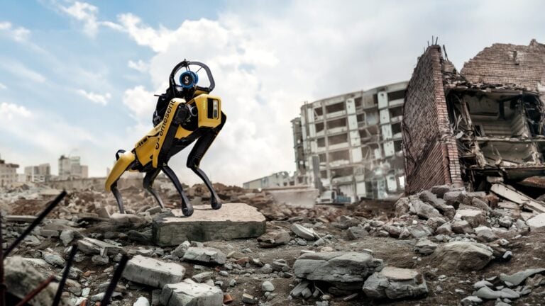
Critical advantages in the field

svgviewer-output (3)
Quick mount system for UAS, UGV, or vehicle
svgviewer-output (3)
Only 1.6kg /3.5lbs
svgviewer-output (3)
Up to 300m LiDAR range. 1m+ points per second
svgviewer-output (3)
IP65 rating for water and dust
svgviewer-output (3)
Edge computing for real-time insights
svgviewer-output (3)
Ability to disable Wi-Fi

Use cases

DefenseTunnel_still-1024x576

Tunnel / Underground Reconnaissance

Send a Hovermap-enabled UAS or UGV into challenging Sub-T environments to map them without putting troops at harm. Use the 3D data to plan breaches and clear buildings / tunnels before entering.

Asset Monitoring and as-builts

Scan ports and wharfs (above and below deck) to assess condition and plan for upgrades. Generate up-to-date 3D models of vessels to plan for upgrades and retrofits.

Indoor / Building Mapping

Map buildings or an entire campus or town both indoors and outdoors for mission planning, route planning, rehearsals, and more. Use a combination of backpack, drone or UGV-based Hovermap capture and combine the data for a detailed, unified 3D view in Emesent Aura.

Point-cloud-Bridge_1200pxW-1024x649

Military Survey and GEOINT

Rapidly map tunnels, buildings, bridges, terrain etc. and use the accurate 3D data for pre-mission planning, simulations, training, hazard detection, route clearance etc. Produce geospatial information artefacts such as topographic maps, digital surface models, and digital terrain models.

BuildingPublicSafetyCBRNe_1400pxW-1024x595

CBRNe Incident Response and Forensic Site Mapping

Collect 360-degree images and 3D LiDAR data rapidly and without disturbing the scene. Use the Hovermap SCBA mount or tactical vest Molle mount to carry Hovermap through a CBRNe scene without disrupting other collection workflows. Produce a 3D view or 2D floorplan of a scene within minutes and use for mission / response planning and communication.

SPOT_Earthquake-3-of-3_1400pxW-768x432

Explosive Ordnance Disposal (EOD)

Deploy Hovermap on an EOD robot for enhanced 3D situational awareness. Use the live streamed 3D view to aid navigation through complex environments and assess threats. Use the 3D data for Explosive Blast Modelling – analyze the structural impacts of an IED attack and estimate bomb threat standoff distances to provide physical security. 

Defense_Change-detection-1024x600

Change Detection and Battle Damage Assessment

Compare before / after scans to detect changes as small as 5mm. Use detected changes for BDA or to identify suspicious objects, earthworks or sub-canopy structures.

CBRNE_chemical-spill_900pxW

Sensitive Site Exploitation (SSE)

Rapidly capture a precise 3D representation of a site together with 360-degree images for a visual and special record that can be interrogated later. Perform virtual walk-throughs, take measurements and accurately locate image features in the 3D scene.

Further Reading

CBRNE_chemical-spill_900pxW

Decision support for CBRNe

cover_image_Accuracy_600pxH

Hovermap Accuracy Report

BuildingPublicSafetyCBRNe_1400pxW-1024x595

3D data for decision-making in Public Safety