Full autonomy
Delivers advanced navigation that enables deployment beyond communications range and BVLOS with no additional infrastructure required, with or without GPS

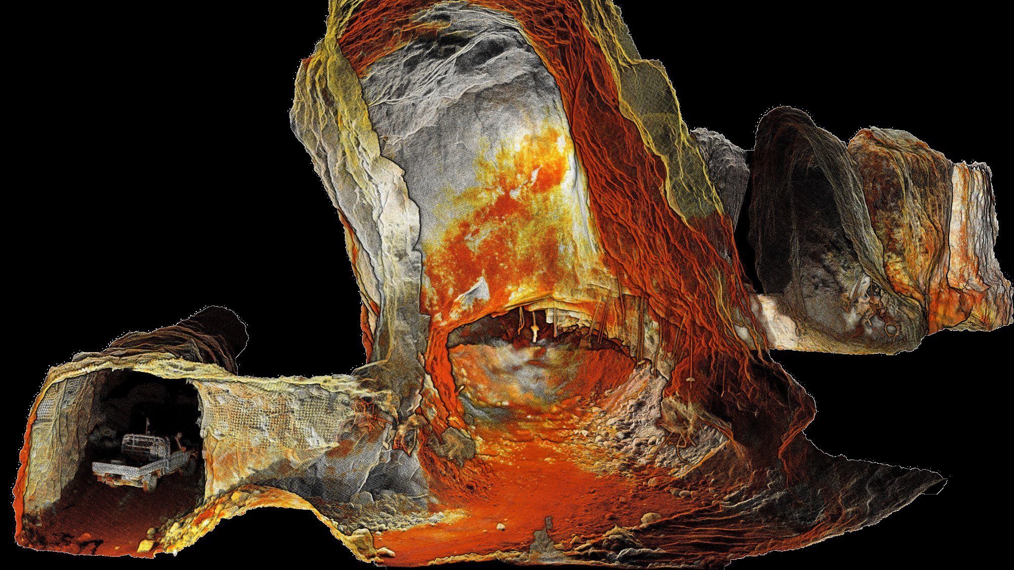
World-leading SLAM
Proven reliability in challenging environments where other SLAM systems fail
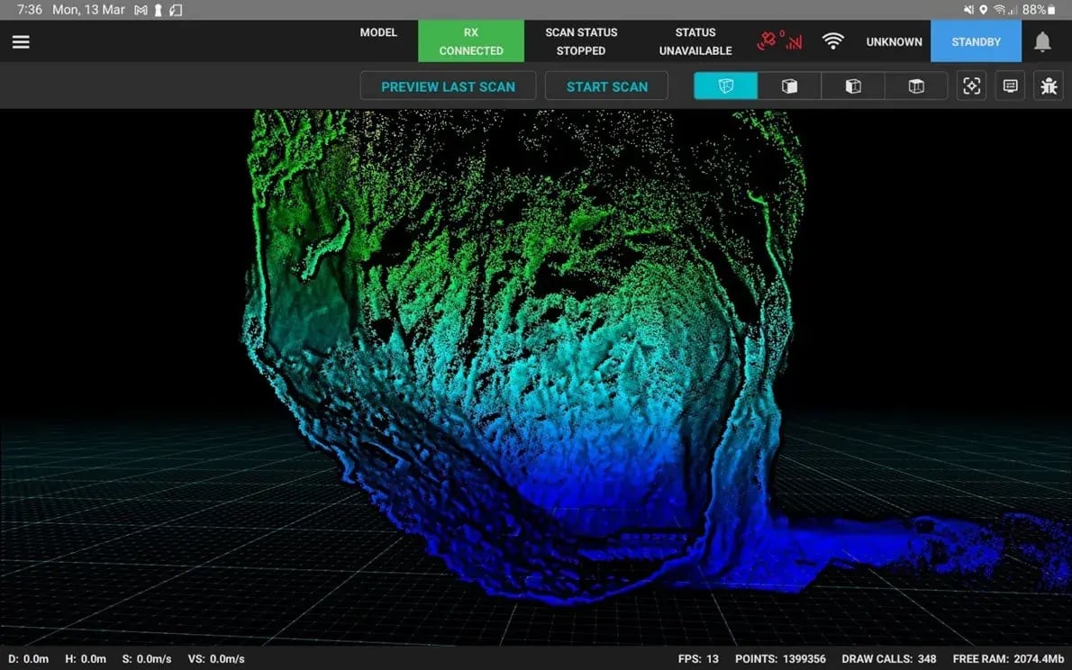
Real time visualization
Preview the point cloud as you scan to ensure complete data capture

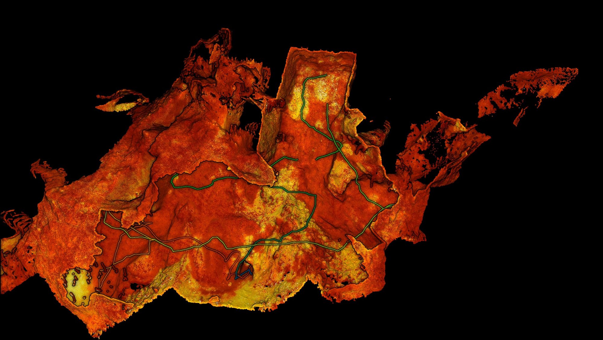
Automated georeferencing
Improves accuracy and eliminates labor-intensive and time-consuming processes

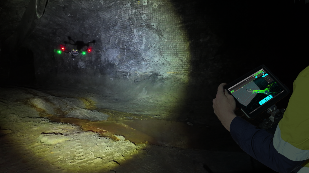
Advanced collision avoidance
Provides a virtual safety bubble, allowing the drone to fly safely in complex GPS-denied environments

Built in fail-safes
A tiered warning and notification system keeps you informed of any necessary action required during your scan to keep the mission on track

Return to home
The drone will return to home if communication is lost.

Dust filtering
Safer, more confident flying even in heavy dust environments

Versatile deployment
Single device is easily switched between multiple deployment platforms